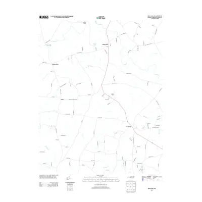
2013 Map of Red Oak
USGS Topo · Published 2013About this map
Red Oak anchors the southeastern portion of this Nash County landscape, where the rural character is defined by a dense network of family-named roads and agrarian land patterns. The terrain is partitioned by several drainage systems, most notably Swift Cr and Pig Basket Cr, which create natural boundaries between historical community centers. Small crossroads settlements like Hilliardston, Taylors Store, and Dukes suggest a legacy of local commerce and social hubs, often linked by thoroughfares such as Philadelphia Church Rd and York Chapel Rd. The presence of the Double S Airport and Coopers Pond reflects the area's mix of private utility and resource management. This map documents a transition in rural North Carolina where traditional road names like Taylors Gin Rd and Wheeles Cabin Rd persist alongside modern infrastructure, preserving a record of family tracts and community transit routes.
Find a feature on this map
98 named features on this map. Tap any name to fly to it.
Don’t see what you’re looking for? This feature index may not catch every label — zoom into the map to look around manually.
Map Details
Editions of this 2013 Red Oak Map
This is the sole edition of this map. No revisions or reprints were ever made.
Other maps of this area

1902 · Rocky Mount
USGS Topo · 1:62,500

1902 · Spring Hope
USGS Topo · 1:62,500

1904 · Rocky Mount
USGS Topo · 1:62,500

1904 · Springhope
USGS Topo · 1:62,500

1953 · Norfolk
USGS Topo · 1:250,000

1953 · Rocky Mount
USGS Topo · 1:250,000

1953 · Raleigh
USGS Topo · 1:250,000

1953 · Greensboro
USGS Topo · 1:250,000

1954 · Greensboro
USGS Topo · 1:250,000

1954 · Rocky Mount
USGS Topo · 1:250,000