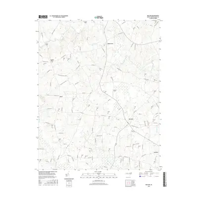
2016 Map of Red Oak
USGS Topo · Published 2016About this map
Red Oak and the surrounding rural landscape of Nash County are defined by a dense network of family cemeteries and winding waterways. This 2016 survey illustrates the persistent agricultural character of the region, where numerous burial sites such as Saint Johns Cem, Boseman Cem, and Arrington Cem are preserved among the fields. The terrain is drained by Swift Creek and Big Basket Cr, with historic crossing points like Coopers Bridge and Drakes Bridge connecting the patchwork of local roads. Small hubs of activity are clustered at Taylors Store and Dortches, while the presence of the Double S Airport and scattered residential expansion along Cedar Grove School Loop Rd shows the modern evolution of these historic crossroads. The map offers a clear view of land divisions and property access, making it a valuable tool for tracing local genealogy and land use patterns.
Find a feature on this map
111 named features on this map. Tap any name to fly to it.
Don’t see what you’re looking for? This feature index may not catch every label — zoom into the map to look around manually.
Map Details
Editions of this 2016 Red Oak Map
This is the sole edition of this map. No revisions or reprints were ever made.
Other maps of this area

1902 · Rocky Mount
USGS Topo · 1:62,500

1902 · Spring Hope
USGS Topo · 1:62,500

1904 · Rocky Mount
USGS Topo · 1:62,500

1904 · Springhope
USGS Topo · 1:62,500

1953 · Norfolk
USGS Topo · 1:250,000

1953 · Rocky Mount
USGS Topo · 1:250,000

1953 · Raleigh
USGS Topo · 1:250,000

1953 · Greensboro
USGS Topo · 1:250,000

1954 · Greensboro
USGS Topo · 1:250,000

1954 · Rocky Mount
USGS Topo · 1:250,000