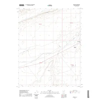
2018 Map of Red Point
USGS Topo · Published 2018About this map
Dennehotso serves as the primary hub in this arid landscape of Northeast Arizona, situated where modern infrastructure meets traditional land divisions. The map highlights the striking geological formation of Comb Ridge to the north, which trends toward Cane Valley, creating a distinct corridor of elevation change across the high desert. To the south, the namesake Red Point stands as a prominent landmark overlooking Greasewood Flat. The drainage of Laguna Cr provides a seasonal pulse to the terrain, crossing the landscape near the Diamond Fields. This 2018 survey details the intricate network of tribal routes, including Indian Rte 6460 and Indian Rte 118, which trace the path of contemporary travel through this ancient geologic setting.
Find a feature on this map
14 named features on this map. Tap any name to fly to it.
Don’t see what you’re looking for? This feature index may not catch every label — zoom into the map to look around manually.
Map Details
Editions of this 2018 Red Point Map
This is the sole edition of this map. No revisions or reprints were ever made.
Other maps of this area

1883 · Marsh Pass
USGS Topo · 1:250,000

1892 · Marsh Pass
USGS Topo · 1:250,000

1892 · Canyon De Chelly
USGS Topo · 1:250,000

1952 · Dinnehotso
USGS Topo · 1:62,500

1952 · Agathla Peak 1 NE
USGS Topo · 1:24,000

1952 · Agathla Peak 1 SE
USGS Topo · 1:24,000

1952 · Setsiltso Springs 2 NW
USGS Topo · 1:24,000

1952 · Setsiltso Springs 2 SW
USGS Topo · 1:24,000

1952 · Setsiltso Springs 2 SE
USGS Topo · 1:24,000

1952 · Agathla Peak
USGS Topo · 1:62,500