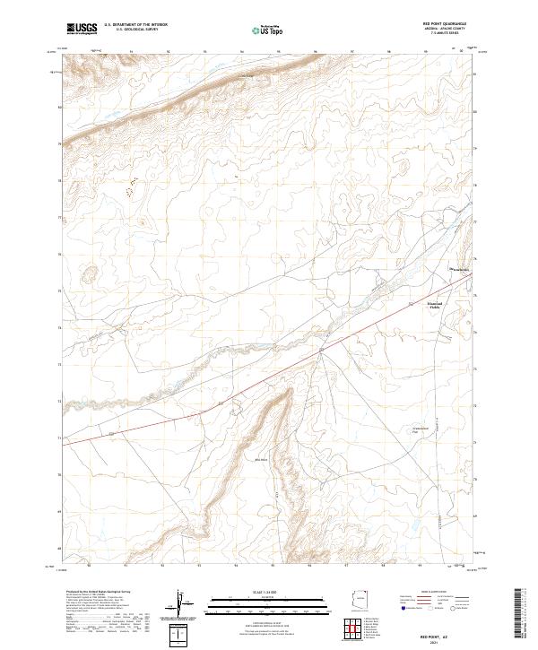
2021 Map of Red Point
USGS Topo · Published 2021About this map
Comb Ridge dominates the northern horizon of this Apache County landscape, where the high desert terrain transitions into the broad expanse of Cane Valley. The settlement of Dennehotso serves as a focal point in the northeast, situated near the intersection of Indian Rte 118 and Indian Rte 6460. The hydrology of the area is defined by the winding course of Laguna Cr, which cuts through the central portion of the sheet toward the Diamond Fields.
Find a feature on this map
14 named features on this map. Tap any name to fly to it.
Don’t see what you’re looking for? This feature index may not catch every label — zoom into the map to look around manually.
Map Details
Editions of this 2021 Red Point Map
This is the sole edition of this map. No revisions or reprints were ever made.
Other maps of this area

1883 · Marsh Pass
USGS Topo · 1:250,000

1892 · Marsh Pass
USGS Topo · 1:250,000

1892 · Canyon De Chelly
USGS Topo · 1:250,000

1952 · Dinnehotso
USGS Topo · 1:62,500

1952 · Agathla Peak 1 NE
USGS Topo · 1:24,000

1952 · Agathla Peak 1 SE
USGS Topo · 1:24,000

1952 · Setsiltso Springs 2 NW
USGS Topo · 1:24,000

1952 · Setsiltso Springs 2 SW
USGS Topo · 1:24,000

1952 · Setsiltso Springs 2 SE
USGS Topo · 1:24,000

1952 · Agathla Peak
USGS Topo · 1:62,500