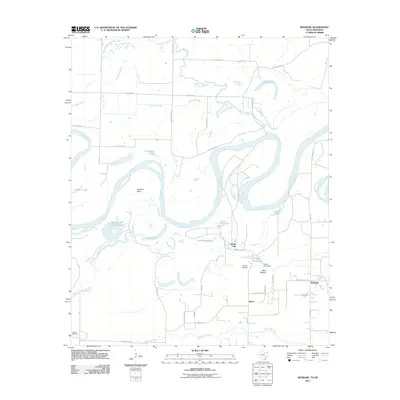
2011 Map of Redbank
USGS Topo · Published 2011About this map
Red River oxbows and secondary waterways dominate this landscape along the Texas and Arkansas border, creating a complex network of sloughs and cut-off lakes. The erratic path of the river is clearly visible through features like Hudson Bow, Applewhite Cut-off Lake, and Little Red Lake, illustrating how the shifting channel has shaped the local geography over decades. Small agricultural settlements and community hubs such as Smith Hill, Burns, and Redbank are connected by a grid of county roads, including FM-1398 and Billy Simms Rd.
Find a feature on this map
40 named features on this map. Tap any name to fly to it.
Don’t see what you’re looking for? This feature index may not catch every label — zoom into the map to look around manually.
Map Details
Editions of this 2011 Redbank Map
This is the sole edition of this map. No revisions or reprints were ever made.
Other maps of this area

1909 · New Boston
USGS Topo · 1:62,500

1909 · Texarkana
USGS Topo · 1:62,500

1950 · Redbank
USGS Topo · 1:24,000

1950 · Ashdown West
USGS Topo · 1:24,000

1950 · Barkman
USGS Topo · 1:24,000

1951 · Redbank
USGS Topo · 1:24,000

1951 · Ashdown West
USGS Topo · 1:24,000

1951 · Barkman
USGS Topo · 1:24,000

1951 · Arden
USGS Topo · 1:24,000

1951 · Foreman
USGS Topo · 1:24,000