Old Maps of Little River County, Arkansas
Explore 121 old maps of Little River County, spanning from 1950 to today. These high-resolution historic maps reveal how streets, neighborhoods, landmarks, and natural features evolved over time — perfect for genealogy, metal detecting, research, and local history exploration.
What you can do with these maps:
- See how Little River County changed over time: Compare historical maps to modern-day views to trace roads, homesites, rail lines & more.
- View detailed metadata: Each map includes creators, publishers, year, scale, and archive source.
- Overlay maps with satellite & LiDAR: Visualize the past alongside modern tools to explore terrain & human change.
- Trusted historical sources: Maps sourced from the USGS, Library of Congress, and other archives.
- Access maps your way: View online, download high-res files, or order prints for personal or research use.
Start exploring old maps of Little River County to uncover forgotten places, hidden landmarks, and the deep history beneath your feet.
Little River County, AR maps
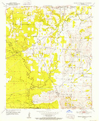
(121)- 1950 Map of Redbank, 1954 Print
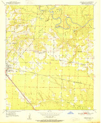
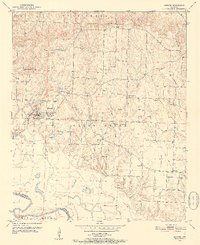
 1950 Redbank1954 Print · USGSBowie County and the Arkansas border are defined by the winding Red River in the early fifties, showing a rural landscape of oxbow lakes and timbered bottoms. Researchers can trace local landmarks like Elizabeth Academy Ch, the Rifle Range (Abandoned), and Hughes Cem.3 unique versions available
 - 1950 Map of Ashdown East, 1956 Print
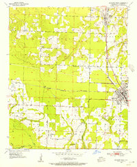
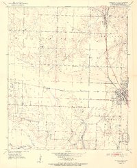
 1950 Ashdown East1956 Print · USGSLittle River County at the midpoint of the century is defined by its winding river oxbows and vital rail junctions. Researchers can trace the path of the Kansas City Southern railroad through Ashdown or locate rural landmarks like Zealia Chapel and Fomby Sch.2 unique versions available
 - 1950 Map of Ashdown West, 1956 Print
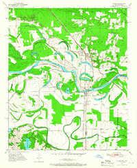
 1950 Ashdown West1956 Print · USGSLittle River County at mid-century centers on the rail crossroads of Ashdown and the rural agricultural lands surrounding it. Researchers can trace historic family landmarks through sites like Richmond Cem, Elmore Ch, and the small community of Wilton.2 unique versions available
 - 1950 Map of Ogden, 1966 Print
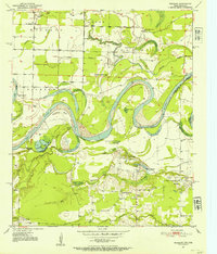
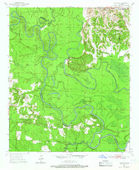
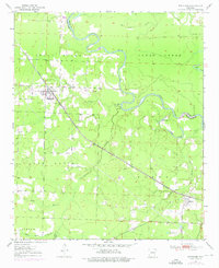
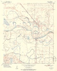
 1950 Ogden1966 Print · USGSThe riverlands of Southwest Arkansas are captured here in the mid-century, where the Red River meanders through a landscape of oxbow lakes and bayous. Researchers can trace the heritage of local communities through named schools and churches like Rosenwald Sch, Summer Hill Ch, and the settlement of Ogden.4 unique versions available
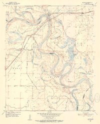
 - 1950 Map of Red Bluff, 1966 Print
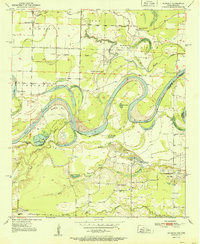
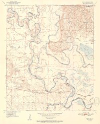
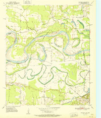
 1950 Red Bluff1966 Print · USGSHempstead and Little River counties are captured at mid-century as the river-and-rail economy shaped local life. Genealogists can locate family landmarks like Saratoga Cemetery, Mt Olive Church, and the site of Ward Ferry.2 unique versions available
 - 1950 Map of Ben Lomond, 1966 Print
 1950 Ben Lomond1966 Print · USGSMid-century Sevier and Little River counties appear here as a patchwork of river-bottom farms and small timber-country settlements. Genealogists and researchers can trace local roots at Rice Chapel, White Cliffs Sch, and the White Cliffs Station along the river.2 unique versions available
 - 1950 Map of Barkman, 1969 Print
 1950 Barkman1969 Print · USGSThe Texas-Arkansas borderlands are captured here at mid-century, where the Red River's shifting path created a rich landscape of oxbow lakes and bayous. Genealogists can trace rural life through landmarks like Rosenwald Sch, Barkman, and the Clear Lake Cem.5 unique versions available
 - 1950 Map of Falls Chapel, 1973 Print
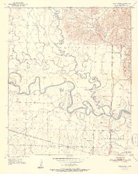
 1950 Falls Chapel1973 Print · USGSThe river bottomlands of Sevier and Little River counties are captured here in the early postwar era, as the Cossatot River meanders toward its confluence. Genealogists can trace family landmarks like Hopson Cem and the Paraclifta Monument or the rail lines of the Kansas City Southern.2 unique versions available
 - 1950 Map of Winthrop, 1976 Print
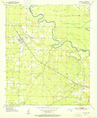
 1950 Winthrop1976 Print · USGSLittle River County and Sevier County are captured here at mid-century, showcasing the intersection of the rail economy and the river lowlands. Researchers can trace the path of the Kansas City Southern railroad as it connects Winthrop and Alleene, or locate family sites near Alleene Cem and Freeman Cem.
 - 1951 Map of Winthrop
 1951 Winthrop1951 Print · USGSLittle River and Sevier County are captured here in the early fifties, where the railroad and river define local life. Trace family history at Alleene Cem or follow the Kansas City Southern line through Winthrop and Red Lake.2 unique versions available
 - 1951 Map of Redbank
 1951 Redbank1951 Print · USGSThe Red River valley in the early fifties shows a landscape of oxbow lakes and rural settlements straddling the Texas-Arkansas line. Genealogists can locate family landmarks like Elizabeth Academy Ch, the Redbank community, and the Vocational School.
 - 1951 Map of Ben Lomond
 1951 Ben Lomond1951 Print · USGSSevier County and the Little River bottomlands are captured here in the early fifties during a period of steady rural development. Genealogists can trace family roots through landmarks like Rice Chapel, Brownstown Cemetery, and the White Cliffs School.2 unique versions available
 - 1951 Map of Ashdown West
 1951 Ashdown West1951 Print · USGSLittle River County at mid-century centers on the rail hub of Ashdown and the surrounding farm communities. Genealogists can trace family landmarks like Richmond Cem or visit rural congregations such as St Matthews Ch and Oak Grove Ch.2 unique versions available
 - 1951 Map of Ogden
 1951 Ogden1951 Print · USGSThe Red River borderlands of Arkansas and Texas come alive in this mid-century survey, showcasing a landscape of shifting oxbows and rural crossings. Researchers can trace local heritage through the Rosenwald Sch, St Johns Ch, and the rail stop at Ogden.2 unique versions available
 - 1951 Map of Red Bluff
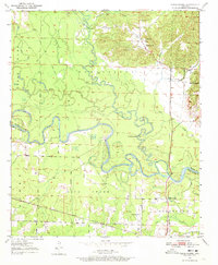
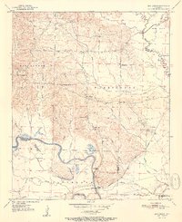
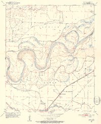
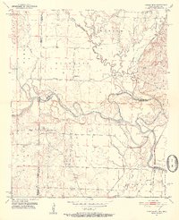
 1951 Red Bluff1951 Print · USGSHempstead County at the start of the fifties shows a landscape shaped by the winding oxbows of the Little River. Genealogists and researchers can trace local family roots at Saratoga Cem or locate the rail-side community of Red Bluff along the ST Louis San Francisco line.2 unique versions available
 - 1951 Map of Falls Chapel
 1951 Falls Chapel1951 Print · USGSSevier County bottomlands come into focus in the early 1950s where the river forks met the rail line. Genealogists can locate family landmarks like Hopson Cem, Pattors Store, and the site of the Paraclifta Monument.2 unique versions available
 - 1951 Map of Ashdown East
 1951 Ashdown East1951 Print · USGSLittle River County at mid-century was a landscape defined by the winding Little River and a busy network of southern rail lines. Researchers can trace rural life through landmarks like Peytonville, Zealia Chapel, and the Fomby Sch schoolhouse.2 unique versions available
 - 1951 Map of Barkman
 1951 Barkman1951 Print · USGSBowie County, Texas, and the Arkansas borderlands are captured here in the early fifties, dominated by the serpentine coils of the Red River. Researchers can locate family landmarks like the Rosenwald Sch, Clear Lake Cem, and the riverfront settlement of Barkman.
 - 1951 Map of Arden, 1952 Print
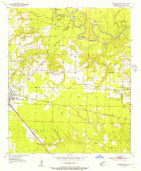
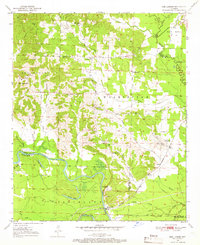
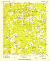
 1951 Arden1952 Print · USGSLittle River County at the dawn of the fifties shows a landscape of rail-dependent settlements and quiet bottomlands. Local historians can trace the rural church and school network through Nolen Sch, Wade Chapel, and Pine Grove Cem.4 unique versions available
 - 1951 Map of Homan, 1952 Print
 1951 Homan1952 Print · USGSThe Red River lowlands of Miller County are captured here in the early fifties, showing a landscape shaped by water and rail. Genealogists and local historians can trace the community around Homan, Paup Cem, and the Missouri Pacific railroad corridor.6 unique versions available
 - 1951 Map of Mineral Springs South, 1952 Print
 1951 Mineral Springs South1952 Print · USGSHoward County's agricultural and industrial landscape is captured here in the early 1950s. Genealogists and historians can trace community roots through landmarks like the County Training Sch in Tollette and the riverfront at Saline Landing.4 unique versions available
 - 1951 Map of Fulton, 1952 Print
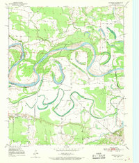
 1951 Fulton1952 Print · USGSThe Red River bottomlands of Southwest Arkansas are captured here in the early fifties, where the railroad meets a shifting river. Genealogists and local historians can trace the foundations of Fulton, locate the Old Allens Ferry site, or find rural landmarks like Galilee Ch and Red Hill Cem.6 unique versions available
 - 1951 Map of Arkinda, 1952 Print
 1951 Arkinda1952 Print · USGSThe Oklahoma and Arkansas borderlands in the early fifties reveal a landscape of cross-state rail lines and small country school districts. Researchers can trace the junction of the Kansas City Southern and Arkinda community, alongside historic sites like Saints Rest Ch and Oak Grove Sch.4 unique versions available
 - 1951 Map of Cerrogordo, 1952 Print
 1951 Cerrogordo1952 Print · USGSThe Oklahoma-Arkansas borderlands come alive in the early fifties, showing the meandering Little River and the communities along its banks. Genealogists and local historians can locate vanished landmarks like Plainview Sch, Pauley Cem, and the old settlement at Cerrogordo.4 unique versions available
 - 1951 Map of Horatio, 1952 Print
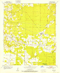
 1951 Horatio1952 Print · USGSSevier County's rail-and-river landscape comes alive in the early fifties, centered on the Kansas City Southern corridor. Genealogists can trace family footprints at Old Central Ch, Norwoodville Cem, and the Beacon Hill Sch.3 unique versions available
Showing maps 1-25 of 121
Top cities of Little River County
- Ashdown historical maps
- Foreman historical maps
- Wilton historical maps
- Ogden historical maps
- Winthrop historical maps
Frequently asked questions
- What are the different types of historical maps available for Little River County?
- What is the oldest map of Little River County?
- Where can I purchase historical maps of Little River County for my home or office?
- Where can I download high-res historical maps of Little River County?
- Are there historical topographic maps available for Little River County?
- Is there historical aerial imagery available for Little River County?
- Where are historical maps of Little River County sourced from?