
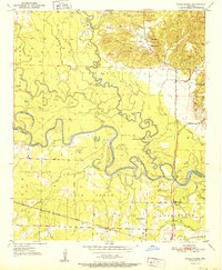
1951 Map of Falls Chapel
USGS Topo · Published 1951About this map
Cossatot River and the Little River converge in this 1951 study of the Arkansas lowlands, creating a landscape defined by oxbows like Red Lake and marshy features such as Davis Slough and Big Slough. The settlement at Ben Lomond and the namesake Falls Chapel serve as local anchors, while the Paraclifta Monument marks the site of a significant early county seat. The southern portion of the map is dominated by the Kansas City Southern railroad, which cuts through the bottomlands near Lick Creek. Small rural landmarks, including Pattors Store, Millers Crossing, and family cemeteries like Hopson Cem and Mills Cem, provide critical points of interest for genealogists tracing family histories in the Sevier and Little River county line area.
Find a feature on this map
29 named features on this map. Tap any name to fly to it.
Don’t see what you’re looking for? This feature index may not catch every label — zoom into the map to look around manually.
Map Details
Editions of this 1951 Falls Chapel Map
2 editions found
Other maps of this area

1950 · Ashdown East
USGS Topo · 1:24,000

1950 · Ashdown West
USGS Topo · 1:24,000

1950 · Ben Lomond
USGS Topo · 1:24,000

1950 · Falls Chapel
USGS Topo · 1:24,000

1950 · Winthrop
USGS Topo · 1:24,000

1951 · Winthrop
USGS Topo · 1:24,000

1951 · Ben Lomond
USGS Topo · 1:24,000

1951 · Ashdown West
USGS Topo · 1:24,000

1951 · Ashdown East
USGS Topo · 1:24,000

1951 · Arden
USGS Topo · 1:24,000