
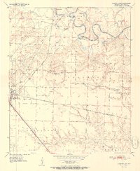
1951 Map of Ashdown East
USGS Topo · Published 1951About this map
The Little River meanders through the heart of Little River County, creating a landscape of oxbow lakes and complex waterways such as Horseshoe Lake, Mud Lake, and Yarborough Lake. In the early 1950s, the eastern outskirts of Ashdown and the smaller settlement of Peytonville were hubs of local life, supported by the intersecting lines of the St. Louis San Francisco and Kansas City Southern railroads. This network of rails and riverbanks defined the transportation of the era, connecting remote farmsteads to regional markets.
Find a feature on this map
27 named features on this map. Tap any name to fly to it.
Don’t see what you’re looking for? This feature index may not catch every label — zoom into the map to look around manually.
Map Details
Editions of this 1951 Ashdown East Map
2 editions found
Other maps of this area

1950 · Ashdown East
USGS Topo · 1:24,000

1950 · Ashdown West
USGS Topo · 1:24,000

1950 · Ogden
USGS Topo · 1:24,000

1950 · Red Bluff
USGS Topo · 1:24,000

1950 · Ben Lomond
USGS Topo · 1:24,000

1950 · Barkman
USGS Topo · 1:24,000

1950 · Falls Chapel
USGS Topo · 1:24,000

1951 · Ben Lomond
USGS Topo · 1:24,000

1951 · Ashdown West
USGS Topo · 1:24,000

1951 · Ogden
USGS Topo · 1:24,000