
1966 Map of Redfield South
USGS Topo · Published 1967About this map
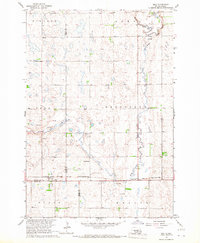
Redfield serves as the focal point of this mid-1960s survey, positioned at the junction of the Chicago and North Western and the C M St P & P railroads. The town's industrial and transportation infrastructure is well-defined, featuring the Redfield Airport and numerous gravel pits that hint at the region's extraction activities during the Missouri River Basin development era. The surrounding landscape in Spink County is dominated by the meandering path of Turtle Creek, which cuts through the townships of Redfield and Exline.
Find a feature on this map
18 named features on this map. Tap any name to fly to it.
Don’t see what you’re looking for? This feature index may not catch every label — zoom into the map to look around manually.
Map Details
Editions of this 1966 Redfield South Map
This is the sole edition of this map. No revisions or reprints were ever made.
Other maps of this area

1895 · Byron
USGS Topo · 1:125,000

1899 · Redfield
USGS Topo · 1:125,000

1953 · Redfield North
USGS Topo · 1:24,000

1953 · Ashton
USGS Topo · 1:24,000

1953 · Huron
USGS Topo · 1:250,000

1954 · Huron
USGS Topo · 1:250,000
1966 · Zell
USGS Topo · 1:24,000

1966 · Redfield SW
USGS Topo · 1:24,000

1967 · Frankfort SW
USGS Topo · 1:24,000

1967 · Tulare NW
USGS Topo · 1:24,000