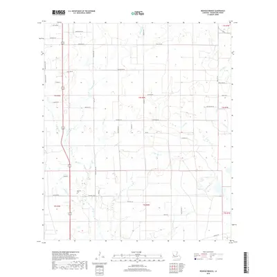
2018 Map of Redhead Branch
USGS Topo · Published 2018About this map
Barentine Cem and Memorial Church stand as local landmarks in this rural Beauregard Parish landscape, where the terrain is defined by an intricate network of waterways. The drainage pattern is dominated by Redhead Br and Barnes Cr, which feed into larger systems like Caney Cr and its tributaries. This 2018 survey reveals a grid of parish roads and private lanes, such as Dean Cryer Rd and Henry Farris Rd, that navigate around numerous small branches and gullies including Long Gully and Barrantine Br. The mapping of these minor watercourses alongside named family roads provides a detailed view of the rural settlement pattern and land use in this part of southwestern Louisiana.
Find a feature on this map
57 named features on this map. Tap any name to fly to it.
Don’t see what you’re looking for? This feature index may not catch every label — zoom into the map to look around manually.
Map Details
Editions of this 2018 Redhead Branch Map
This is the sole edition of this map. No revisions or reprints were ever made.
Other maps of this area

1935 · Longville
USGS Topo · 1:31,680

1947 · DeRidder
USGS Topo · 1:31,680

1947 · Kernan
USGS Topo · 1:31,680

1947 · Ikes
USGS Topo · 1:31,680

1947 · Reeves
USGS Topo · 1:31,680

1947 · Longville
USGS Topo · 1:31,680

1947 · Bundick
USGS Topo · 1:31,680

1947 · Beckwith School
USGS Topo · 1:31,680

1947 · Sugartown
USGS Topo · 1:31,680

1947 · Bannister
USGS Topo · 1:31,680