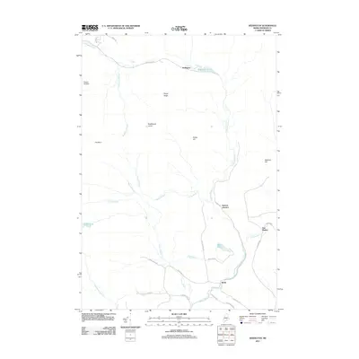
2011 Map of Redington
USGS Topo · Published 2011About this map
Orbeton Stream and its numerous tributaries, including Hardy Stream and Conant Stream, define the drainage patterns of this high-elevation Franklin County landscape. Small, scattered settlements such as Redington and East Madrid occupy the lower reaches of the valley, while the terrain rises sharply to named peaks like The Horn, Saddleback Junior, and Potato Nubble. The geography here is shaped by water and elevation, with Redington Pond and Beal Pond tucked between ridges like Poplar Ridge. The network of backroads, including Reeds Mill Rd and Fish Hatchery Rd, suggests a long history of local industry and natural resource management. Perham Junction and Reeds stand as notable points along the Railroad Rd, illustrating the historical connectivity required to navigate this mountainous region of Maine.
Find a feature on this map
32 named features on this map. Tap any name to fly to it.
Don’t see what you’re looking for? This feature index may not catch every label — zoom into the map to look around manually.
Map Details
Editions of this 2011 Redington Map
This is the sole edition of this map. No revisions or reprints were ever made.
Other maps of this area

1928 · Stratton
USGS Topo · 1:48,000

1929 · Phillips
USGS Topo · 1:48,000

1932 · Phillips
USGS Topo · 1:62,500

1932 · Stratton
USGS Topo · 1:62,500

1932 · Kennebago Lake
USGS Topo · 1:48,000

1933 · Rangeley
USGS Topo · 1:48,000

1935 · Kennebago Lake
USGS Topo · 1:62,500

1936 · Kennebago Lake
USGS Topo · 1:62,500

1939 · Rangeley
USGS Topo · 1:62,500

1949 · Jackman
USGS Topo · 1:250,000
Featured Places
- Phillips, ME
- Madrid Township, ME
- Sandy River Plantation, ME
- East Madrid, Madrid Township
- Mount Abram Township, ME