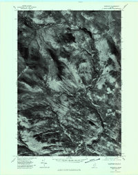
1977 Map of Redington
USGS Topo · Published 1983About this map
Orbeton Stream carves a deep path through this section of Franklin County, defining the drainage patterns of a landscape dominated by the high-elevation peaks of Saddleback Junior and The Horn. This 1977 orthophotoquad provides a clear view of the timbered terrain and the intricate logging road networks that serve the area’s high-country economy. At the confluence of these waterways and old rail grades lie the small settlements of Redington, Perham Junction, and East Madrid. The visual data reveals how the placement of these crossroads was dictated by the narrow valleys of Conant Stream and Saddleback Stream. For the researcher, this imagery captures the exact state of land use and forest cover during the late 1970s, showing the specific clearings and structural footprints of these remote upland communities before decades of secondary forest growth could obscure them.
Find a feature on this map
8 named features on this map. Tap any name to fly to it.
Don’t see what you’re looking for? This feature index may not catch every label — zoom into the map to look around manually.
Map Details
Editions of this 1977 Redington Map
This is the sole edition of this map. No revisions or reprints were ever made.
Other maps of this area

1928 · Stratton
USGS Topo · 1:48,000

1929 · Phillips
USGS Topo · 1:48,000

1932 · Phillips
USGS Topo · 1:62,500

1932 · Stratton
USGS Topo · 1:62,500

1932 · Kennebago Lake
USGS Topo · 1:48,000

1933 · Rangeley
USGS Topo · 1:48,000

1935 · Kennebago Lake
USGS Topo · 1:62,500

1936 · Kennebago Lake
USGS Topo · 1:62,500

1939 · Rangeley
USGS Topo · 1:62,500

1949 · Jackman
USGS Topo · 1:250,000
Featured Places
- Phillips, ME
- Madrid Township, ME
- Sandy River Plantation, ME
- East Madrid, Madrid Township
- Mount Abram Township, ME