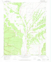
1968 Map of Redmesa
USGS Topo · Published 1975About this map
Red Mesa dominates the northern landscape of this survey, which straddles the Colorado and New Mexico border. The settlement patterns around Redmesa and Marvel reveal a high-desert agricultural community deeply tied to water management, as evidenced by the Enterprise Ditch and Pioneer Ditch systems drawing from the La Plata River. South of the Southern Ute Indian Reservation Boundary, the terrain shifts into a series of deep canyons and washes, including Morgan Canyon, Johnson Canyon, and Mefford Wash. The map documents a rugged geography where ranching and early energy exploration coincide, shown by various drill holes and the presence of a central Landing Area. To the southeast, the distinct volcanic features of Cinder Bluffs and South Cinder Butte provide prominent landmarks in the high plateau country.
Find a feature on this map
42 named features on this map. Tap any name to fly to it.
Don’t see what you’re looking for? This feature index may not catch every label — zoom into the map to look around manually.
Map Details
Editions of this 1968 Redmesa Map
3 editions found
Other maps of this area

1889 · Chaco
USGS Topo · 1:250,000

1892 · Chaco
USGS Topo · 1:250,000

1912 · Soda Canyon
USGS Topo · 1:62,500

1913 · Red Mesa
USGS Topo · 1:62,500

1915 · Soda Canyon
USGS Topo · 1:62,500

1954 · Shiprock
USGS Topo · 1:250,000

1956 · Cortez
USGS Topo · 1:250,000

1958 · Cortez
USGS Topo · 1:250,000

1958 · Shiprock
USGS Topo · 1:250,000

1959 · Shiprock
USGS Topo · 1:250,000