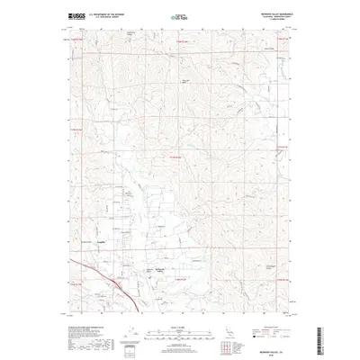
2018 Map of Redwood Valley
USGS Topo · Published 2018About this map
Redwood Valley and its surrounding Mendocino County landscape are defined by the winding course of the Russian River and an intricate network of irrigation infrastructure. This 2018 survey documents the agricultural and residential patterns of the region, showing the importance of water management through features like the Powerhouse Canal and W Canal. To the west, the settlement of Laughlin sits near McGee Canyon, while the eastern hills are carved by the dramatically named Hells Delight Canyon.
Find a feature on this map
70 named features on this map. Tap any name to fly to it.
Don’t see what you’re looking for? This feature index may not catch every label — zoom into the map to look around manually.
Map Details
Editions of this 2018 Redwood Valley Map
This is the sole edition of this map. No revisions or reprints were ever made.
Other maps of this area

1920 · Ukiah
USGS Topo · 1:62,500

1922 · Willits
USGS Topo · 1:62,500

1942 · Willits
USGS Topo · 1:62,500

1943 · Pomo
USGS Topo · 1:62,500

1943 · Boonville
USGS Topo · 1:62,500

1944 · Ukiah
USGS Topo · 1:62,500

1944 · Willits
USGS Topo · 1:62,500

1957 · Ukiah
USGS Topo · 1:250,000

1958 · Ukiah
USGS Topo · 1:24,000

1958 · Cow Mountain
USGS Topo · 1:24,000