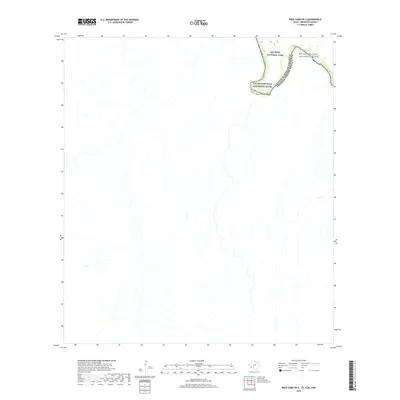
2019 Map of Reed Camp OE S
USGS Topo · Published 2019About this map
Big Bend National Park defines the northeastern corner of this remote Texas borderland, where the Chihuahuan Desert landscape meets the international boundary. This specific area captures the northern bend of the Rio Grande Wild and Scenic River, marking the geopolitical divide between the United States of America and Estados Unidos Mexicanos. The terrain is characterized by a dense network of ephemeral desert washes and intermittent streams that drain toward the river, illustrating the complex natural drainage patterns of Brewster County. Because the river channel shifts over time, this modern survey provides a precise look at the river's course and the corresponding park boundaries in this sparsely populated region of the Trans-Pecos.
Find a feature on this map
3 named features on this map. Tap any name to fly to it.
Don’t see what you’re looking for? This feature index may not catch every label — zoom into the map to look around manually.
Map Details
Editions of this 2019 Reed Camp OE S Map
This is the sole edition of this map. No revisions or reprints were ever made.
Other maps of this area

1903 · Chisos Mountains
USGS Topo · 1:125,000

1905 · Chisos Mountains
USGS Topo · 1:125,000

1959 · Emory Peak
USGS Topo · 1:250,000

1965 · Emory Peak
USGS Topo · 1:250,000
1971 · Reed Camp
USGS Topo · 1:24,000
1971 · Smoky Creek
USGS Topo · 1:24,000

1985 · Chisos Mountains
USGS Topo · 1:100,000
2010 · Smoky Creek
USGS Topo · 1:24,000
2010 · Mariscal Mountain OE S
USGS Topo · 1:24,000
2010 · Reed Camp
USGS Topo · 1:24,000