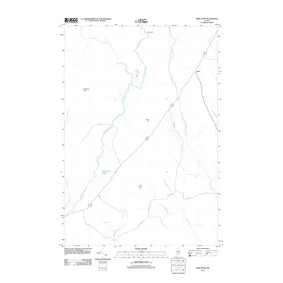
2011 Map of Reed Pond
USGS Topo · Published 2011About this map
Reed Plantation and the surrounding wilderness are defined by an intricate network of waterways and high ground in this 2011 topographic survey. The landscape is anchored by the prominent Macwahoc Ridge and Beech Hill, while the Whitney Fire Tower stands as a notable landmark for fire lookout and navigation. The drainage pattern is complex, with the Macwahoc Stream and Wytopitlock Stream carving through the terrain, supplemented by smaller water bodies like Reed Pond and Juniper Brook. Local infrastructure is marked by several named thoroughfares, including Springer Rd and Jellison Rd, providing access to these timbered highlands. The map illustrates a rural Maine environment where the primary settlement at Reed is situated at the intersection of vital transit routes and several brooks, including Finn Brook and Prouty Brook, highlighting the area's historical reliance on its river systems.
Find a feature on this map
22 named features on this map. Tap any name to fly to it.
Don’t see what you’re looking for? This feature index may not catch every label — zoom into the map to look around manually.
Map Details
Editions of this 2011 Reed Pond Map
This is the sole edition of this map. No revisions or reprints were ever made.
Other maps of this area

1940 · Sherman
USGS Topo · 1:62,500

1940 · Mattawamkeag
USGS Topo · 1:62,500

1941 · Mattawamkeag Lake
USGS Topo · 1:62,500

1941 · Wytopitlock
USGS Topo · 1:62,500

1942 · Mattawamkeag
USGS Topo · 1:62,500

1942 · Sherman
USGS Topo · 1:62,500

1943 · Wytopitlock
USGS Topo · 1:62,500

1943 · Mattawamkeag Lake
USGS Topo · 1:62,500

1954 · Millinocket
USGS Topo · 1:250,000

1958 · Millinocket
USGS Topo · 1:250,000
Featured Places
- Reed Plantation, ME
- Reed, Reed Plantation
- Macwahoc Plantation, ME
- Drew Plantation, ME
- Upper Molunkus Township, ME