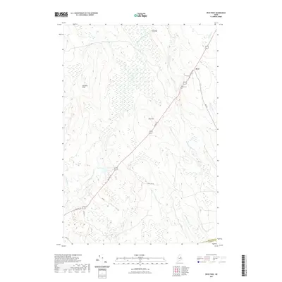
2021 Map of Reed Pond
USGS Topo · Published 2021About this map
The Military Rd corridor anchors this portion of southern Aroostook County, tracing a historic path through a landscape defined by its complex hydrology and ridges. This modern survey shows the settlement of Reed at the intersection of Main St and Highway 171, surrounded by a network of waterways including the Macwahoc Stream and Wytopitlock Stream. The terrain is marked by significant elevations like Macwahoc Ridge and Beech Hill, which rise above the extensive wetlands and brooks that drain toward Reed Pond. Genealogists will find the locations of Clifford Cem and Rollins Cem near the town center, providing precise coordinates for local family history research. The boundary between Aroostook Co and Penobscot Co is clearly delineated in the southern portion of the map, illustrating how the regional geography transitions between these two northern Maine counties.
Find a feature on this map
23 named features on this map. Tap any name to fly to it.
Don’t see what you’re looking for? This feature index may not catch every label — zoom into the map to look around manually.
Map Details
Editions of this 2021 Reed Pond Map
This is the sole edition of this map. No revisions or reprints were ever made.
Other maps of this area

1940 · Sherman
USGS Topo · 1:62,500

1940 · Mattawamkeag
USGS Topo · 1:62,500

1941 · Mattawamkeag Lake
USGS Topo · 1:62,500

1941 · Wytopitlock
USGS Topo · 1:62,500

1942 · Mattawamkeag
USGS Topo · 1:62,500

1942 · Sherman
USGS Topo · 1:62,500

1943 · Wytopitlock
USGS Topo · 1:62,500

1943 · Mattawamkeag Lake
USGS Topo · 1:62,500

1954 · Millinocket
USGS Topo · 1:250,000

1958 · Millinocket
USGS Topo · 1:250,000
Featured Places
- Reed Plantation, ME
- Reed, Reed Plantation
- Macwahoc Plantation, ME
- Drew Plantation, ME
- Upper Molunkus Township, ME