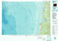
1980 Map of Reedsport
USGS Topo · Published 1987About this map
The Umpqua River and Siuslaw River define this coastal survey, where the timber and fishing industries of the 1980s met the vast ecological features of the central Oregon coast. The map provides a unique dual perspective, combining topographic details of the inland forests with bathymetric data of the Pacific Ocean floor, specifically highlighting the submerged Heceta Bank. Along the shoreline, the Oregon Dunes National Recreation Area spans the coast between Florence and Winchester Bay, a landscape of shifting sands that separates the ocean from a string of freshwater bodies like Siltcoos Lake and Tahkenitch Lake. The Southern Pacific railroad tracks the coast, serving the industrial hubs of Gardiner and Reedsport. On the heights above the river mouth, the Umpqua Lighthouse stands as a sentinel for the maritime traffic navigating the rugged estuary entrance.
Find a feature on this map
55 named features on this map. Tap any name to fly to it.
Don’t see what you’re looking for? This feature index may not catch every label — zoom into the map to look around manually.
Map Details
Editions of this 1980 Reedsport Map
This is the sole edition of this map. No revisions or reprints were ever made.
Other maps of this area

1896 · Coos Bay
USGS Topo · 1:125,000

1898 · Coos Bay
USGS Topo · 1:125,000

1900 · Coos Bay
USGS Topo · 1:125,000

1918 · Mapleton
USGS Topo · 1:48,000

1919 · Earl
USGS Topo · 1:48,000

1920 · Siltcoos Lake
USGS Topo · 1:62,500

1920 · Heceta Head
USGS Topo · 1:62,500

1923 · Reedsport
USGS Topo · 1:62,500

1928 · Sitkum
USGS Topo · 1:125,000

1940 · Mapleton
USGS Topo · 1:62,500