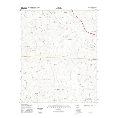
2016 Map of Reepsville
USGS Topo · Published 2016About this map
The South Fork Catawba River winds through this landscape on the border of Catawba and Lincoln counties, anchoring a network of rural settlements and family-named landmarks. Small communities like Blackburn, Reepsville, and Daniels are connected by historical thoroughfares such as the Hickory Lincolnton Hwy and Old State Rd. The northern portion of the map features Rhoney Chapel, a focal point for the local community near Cem.
Find a feature on this map
135 named features on this map. Tap any name to fly to it.
Don’t see what you’re looking for? This feature index may not catch every label — zoom into the map to look around manually.
Map Details
Editions of this 2016 Reepsville Map
This is the sole edition of this map. No revisions or reprints were ever made.
Other maps of this area

1895 · Hickory
USGS Topo · 1:125,000

1909 · Lincolnton
USGS Topo · 1:62,500

1911 · Lincolnton
USGS Topo · 1:62,500

1914 · Gastonia
USGS Topo · 1:48,000

1916 · Gastonia
USGS Topo · 1:62,500

1953 · Charlotte
USGS Topo · 1:250,000

1954 · Charlotte
USGS Topo · 1:250,000

1960 · Charlotte
USGS Topo · 1:250,000

1962 · Charlotte
USGS Topo · 1:250,000
1970 · Banoak
USGS Topo · 1:24,000