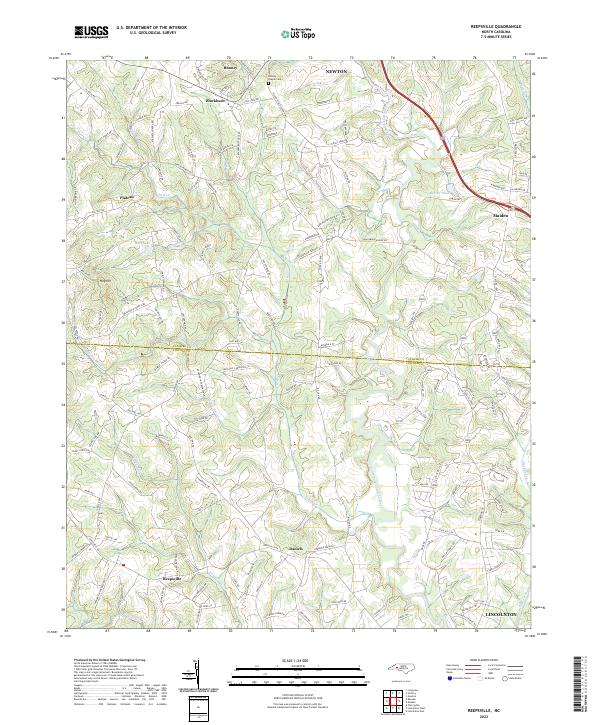
2022 Map of Reepsville
USGS Topo · Published 2022About this map
The South Fork Catawba River winds through this Piedmont landscape, defining the transition between Catawba and Lincoln Counties. Small communities and family-named homesteads such as Rhoney, Blackburn, and Reepsville anchor the rural road network, reflecting a long history of local settlement and agriculture. Significant water features including Pott Cr and Little Pott Cr drain the central valleys, while Rhoney Chapel Cem provides a specific point of interest for those tracing local family lineages. The terrain is marked by distinctive features like Hog Hill and the valley of Clark Creek on the eastern edge. This modern topographic survey illustrates the enduring rural character of the area even as larger municipalities like Maiden and Lincolnton influence the periphery of the quadrangle.
Find a feature on this map
142 named features on this map. Tap any name to fly to it.
Don’t see what you’re looking for? This feature index may not catch every label — zoom into the map to look around manually.
Map Details
Editions of this 2022 Reepsville Map
This is the sole edition of this map. No revisions or reprints were ever made.
Other maps of this area

1895 · Hickory
USGS Topo · 1:125,000

1909 · Lincolnton
USGS Topo · 1:62,500

1911 · Lincolnton
USGS Topo · 1:62,500

1914 · Gastonia
USGS Topo · 1:48,000

1916 · Gastonia
USGS Topo · 1:62,500

1953 · Charlotte
USGS Topo · 1:250,000

1954 · Charlotte
USGS Topo · 1:250,000

1960 · Charlotte
USGS Topo · 1:250,000

1962 · Charlotte
USGS Topo · 1:250,000
1970 · Banoak
USGS Topo · 1:24,000