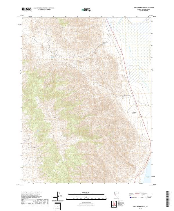
2021 Map of Reese River Canyon
USGS Topo · Published 2021About this map
Wassuk Range peaks dominate the western landscape of this Mineral County quadrangle, descending sharply into the high desert drainage systems of the eastern basin. The arid environment is punctuated by vital water sources like Sulphur Spring and Twilight Spring, which likely served as critical landmarks for travelers and livestock in this portion of the Great Basin. To the east, the terrain opens into the Walker River Valley, where the Walker River flows toward its terminus at the northern edge of Walker Lake. The mapping of deep cuts such as Reese River Canyon, Penrod Canyon, and Deadman Canyon illustrates the complex erosion patterns that define the eastern slopes of the range, providing a clear picture of the geographic barriers and natural corridors present in the early 21st century.
Find a feature on this map
16 named features on this map. Tap any name to fly to it.
Don’t see what you’re looking for? This feature index may not catch every label — zoom into the map to look around manually.
Map Details
Editions of this 2021 Reese River Canyon Map
This is the sole edition of this map. No revisions or reprints were ever made.
Other maps of this area

1909 · Hawthorne
USGS Topo · 1:250,000

1911 · Hawthorne
USGS Topo · 1:250,000

1915 · Hawthorne
USGS Topo · 1:250,000

1948 · Walker Lake
USGS Topo · 1:250,000

1955 · Hawthorne
USGS Topo · 1:62,500

1956 · Mt. Grant
USGS Topo · 1:62,500

1957 · Walker Lake
USGS Topo · 1:250,000

1962 · Walker Lake
USGS Topo · 1:250,000

1964 · Walker Lake
USGS Topo · 1:250,000

1964 · Gillis Canyon
USGS Topo · 1:62,500