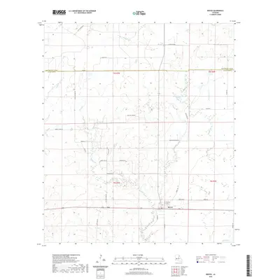
2020 Map of Reeves
USGS Topo · Published 2020About this map
The community of Reeves serves as the focal point of this Allen Parish landscape, situated at the junction of several local routes such as Lyles St and Ford St. The surrounding terrain is defined by a dense network of minor waterways, including the winding course of Clear Cr and Mud Cr. Further west, the small settlement of Bel marks a transition toward more isolated tracts of land, where names like Bel Fire Tower Rd suggest a history of forestry and fire surveillance.
Find a feature on this map
47 named features on this map. Tap any name to fly to it.
Don’t see what you’re looking for? This feature index may not catch every label — zoom into the map to look around manually.
Map Details
Editions of this 2020 Reeves Map
This is the sole edition of this map. No revisions or reprints were ever made.
Other maps of this area

1935 · Mittie
USGS Topo · 1:31,680

1935 · Gaytine
USGS Topo · 1:31,680

1935 · Longville
USGS Topo · 1:31,680

1947 · Gaytine
USGS Topo · 1:31,680

1947 · Le Blanc
USGS Topo · 1:31,680

1947 · Edna
USGS Topo · 1:31,680

1947 · Reeves
USGS Topo · 1:31,680

1947 · Longville
USGS Topo · 1:31,680

1947 · Thompson Bluff
USGS Topo · 1:31,680

1947 · Bundick
USGS Topo · 1:31,680