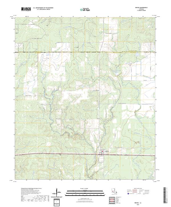
2024 Map of Reeves
USGS Topo · Published 2024About this map
The settlement of Reeves serves as the focal point for this Southwest Louisiana landscape, where the grid of the Public Land Survey System meets a complex network of waterways. Positioned near the boundary of Beauregard Parish and Allen Parish, the terrain is defined by a dense web of drainages including Clear Creek, Cane Brake Creek, and the Bear Cr Watershed Number 1. This area reflects the rural character of the region, where small communities like Bel and Kingery are connected by namesake parish roads and lanes such as Albert Cole Rd and Dunnehoo Rd.
Find a feature on this map
49 named features on this map. Tap any name to fly to it.
Don’t see what you’re looking for? This feature index may not catch every label — zoom into the map to look around manually.
Map Details
Editions of this 2024 Reeves Map
This is the sole edition of this map. No revisions or reprints were ever made.
Other maps of this area

1935 · Mittie
USGS Topo · 1:31,680

1935 · Gaytine
USGS Topo · 1:31,680

1935 · Longville
USGS Topo · 1:31,680

1947 · Gaytine
USGS Topo · 1:31,680

1947 · Le Blanc
USGS Topo · 1:31,680

1947 · Edna
USGS Topo · 1:31,680

1947 · Reeves
USGS Topo · 1:31,680

1947 · Longville
USGS Topo · 1:31,680

1947 · Thompson Bluff
USGS Topo · 1:31,680

1947 · Bundick
USGS Topo · 1:31,680