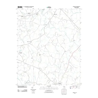
2011 Map of Reidville
USGS Topo · Published 2011About this map
Reidville and Woodruff anchor this landscape where the South Tyger River and Middle Tyger River wind through Spartanburg County. The map details a transition from traditional rural hubs like Dillard Crossroads and Switzer to modern residential developments such as Reidville Acres and WaterOaks. Genealogists will find significant value in the location of the Flint Hill Cemetery and Penden Cemetery, alongside the newer Crestview Memorial Gardens near the southern edge of the quadrangle. The hydrology is particularly intricate, featuring numerous named tributaries like Chickenfoot Creek, Big Ferguson Creek, and Bens Creek. Several local landmarks, including Andersons Bridge and Van Pattons Bridge over the Enoree River, illustrate the historical connectivity of this Piedmont river country.
Find a feature on this map
139 named features on this map. Tap any name to fly to it.
Don’t see what you’re looking for? This feature index may not catch every label — zoom into the map to look around manually.
Map Details
Editions of this 2011 Reidville Map
This is the sole edition of this map. No revisions or reprints were ever made.
Other maps of this area

1935 · Greer
USGS Topo · 1:48,000

1938 · Greer
USGS Topo · 1:62,500

1941 · Spartanburg
USGS Topo · 1:250,000

1947 · Spartanburg
USGS Topo · 1:62,500

1949 · Spartanburg
USGS Topo · 1:24,000

1949 · Spartanburg
USGS Topo · 1:62,500

1953 · Spartanburg
USGS Topo · 1:250,000

1954 · Greenville
USGS Topo · 1:250,000

1957 · Fountain Inn
USGS Topo · 1:62,500

1957 · Greer
USGS Topo · 1:62,500