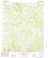
1983 Map of Reidville
USGS Topo · Published 1983About this map
The South Tyger River and its numerous tributaries, including Chickenfoot Creek and Bens Creek, define the landscape of Spartanburg County in the early 1980s. This agricultural and wooded region is anchored by the community of Reidville in the northwest and the northern edge of Woodruff in the south. The map documents a dense network of local landmarks, from rural spiritual centers like Walkers Chapel and Bethlehem Ch to family-named sites such as Dillard Crossroads. The presence of several small burial grounds, including Penden Cem and Flint Hill Cem, offers significant detail for genealogists tracing Upstate families. Along the Enoree River at the southern boundary, the Van Patton Shoals mark a distinct hydrological feature, while the Seaboard railroad line provides a corridor for industry through Switzer.
Find a feature on this map
39 named features on this map. Tap any name to fly to it.
Don’t see what you’re looking for? This feature index may not catch every label — zoom into the map to look around manually.
Map Details
Editions of this 1983 Reidville Map
This is the sole edition of this map. No revisions or reprints were ever made.
Other maps of this area

1935 · Greer
USGS Topo · 1:48,000

1938 · Greer
USGS Topo · 1:62,500

1941 · Spartanburg
USGS Topo · 1:250,000

1947 · Spartanburg
USGS Topo · 1:62,500

1949 · Spartanburg
USGS Topo · 1:24,000

1949 · Spartanburg
USGS Topo · 1:62,500

1953 · Spartanburg
USGS Topo · 1:250,000

1954 · Greenville
USGS Topo · 1:250,000

1957 · Fountain Inn
USGS Topo · 1:62,500

1957 · Greer
USGS Topo · 1:62,500