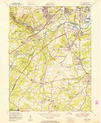
1950 Map of Relay
USGS Topo · Published 1950About this map
The Patapsco River and its deep valleys anchor this postwar landscape, where the historic Thomas Viaduct carries rail traffic across the water between Relay and Elkridge. This mid-century survey captures the region just as the Baltimore Friendship International Airport began to reshape the landscape south of Linthicum Heights. To the west, the winding Rockburn Branch and Lawyers Hill overlook the wooded tracts of Patapsco State Park, while the eastern portion of the map shows a dense network of suburban developments like English Consul and Baltimore Highlands bordering the city line.
Find a feature on this map
69 named features on this map. Tap any name to fly to it.
Don’t see what you’re looking for? This feature index may not catch every label — zoom into the map to look around manually.
Map Details
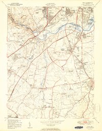
Editions of this 1950 Relay Map
2 editions found
Other maps of this area

1892 · Laurel
USGS Topo · 1:62,500

1892 · Ellicott
USGS Topo · 1:62,500

1894 · Ellicott
USGS Topo · 1:62,500

1894 · Laurel
USGS Topo · 1:62,500

1894 · Baltimore
USGS Topo · 1:62,500

1894 · Relay
USGS Topo · 1:62,500

1897 · Laurel
USGS Topo · 1:62,500

1899 · Baltimore
USGS Topo · 1:62,500

1904 · Baltimore
USGS Topo · 1:62,500

1906 · Ellicott
USGS Topo · 1:62,500