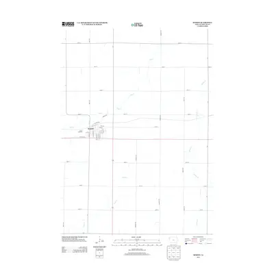
2013 Map of Remsen
USGS Topo · Published 2013About this map
Remsen serves as the primary hub of this northwestern Iowa landscape, where a grid of rural roads meets the winding courses of Deep Cr and Whisky Cr. The town's residential and commercial core is meticulously detailed, showing a street network that includes S Madison St and S Kennedy St, alongside the local Remsen Golf Course on its western edge. Beyond the municipal limits, the map illustrates the agrarian geometry of Plymouth County, defined by long stretches of throughways like Quest Ave and Roosevelt Ave. The drainage patterns of Johns Cr in the southern portion of the quadrangle contrast with the strictly rectilinear section lines, providing a clear picture of how natural waterways dictate the subtle variations in this otherwise ordered plains environment.
Find a feature on this map
34 named features on this map. Tap any name to fly to it.
Don’t see what you’re looking for? This feature index may not catch every label — zoom into the map to look around manually.
Map Details
Editions of this 2013 Remsen Map
This is the sole edition of this map. No revisions or reprints were ever made.
Other maps of this area

1954 · Fort Dodge
USGS Topo · 1:250,000

1955 · Sioux City
USGS Topo · 1:250,000

1957 · Fort Dodge
USGS Topo · 1:250,000

1958 · Sioux City
USGS Topo · 1:250,000

1958 · Fort Dodge
USGS Topo · 1:250,000

1959 · Sioux City
USGS Topo · 1:250,000

1962 · Le Mars
USGS Topo · 1:62,500

1962 · Union Center
USGS Topo · 1:62,500

1969 · Fielding
USGS Topo · 1:24,000
1969 · Granville West
USGS Topo · 1:24,000