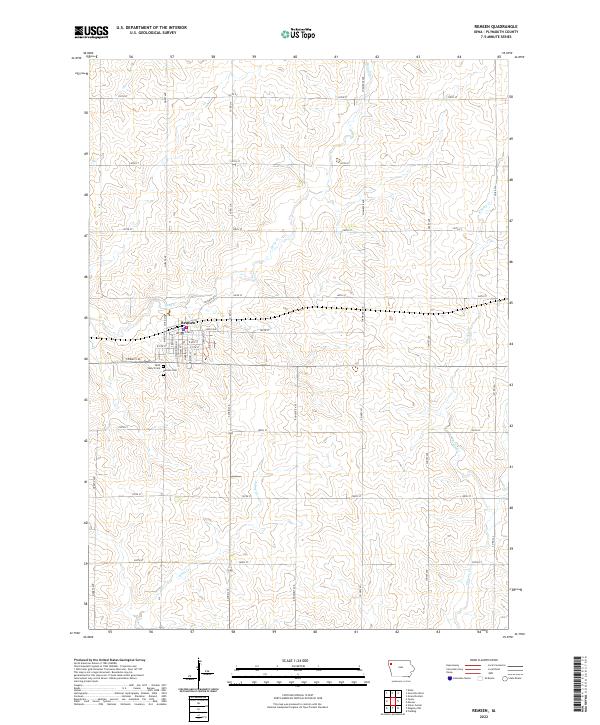
2022 Map of Remsen
USGS Topo · Published 2022About this map
The agricultural landscape of Plymouth County centers on the town of Remsen, where a methodical grid of streets including S Washington St and Lincoln St gives way to the vast farm sections of Northwest Iowa. This 2022 survey illustrates the enduring rural infrastructure, where an extensive network of county routes like Co Rd L12 and Co Rd L14 serves the surrounding homesteads. Water drainage for these fertile plains is provided by several named streams, most notably Whisky Cr, Deep Cr, and Johns Cr, which wind through the township lines of T93N and T92N. Local history is anchored at the southern edge of the settlement by Saint Mary's Cem and Remsen Cem, providing essential markers for genealogical research in this long-established farming community.
Find a feature on this map
40 named features on this map. Tap any name to fly to it.
Don’t see what you’re looking for? This feature index may not catch every label — zoom into the map to look around manually.
Map Details
Editions of this 2022 Remsen Map
This is the sole edition of this map. No revisions or reprints were ever made.
Other maps of this area

1954 · Fort Dodge
USGS Topo · 1:250,000

1955 · Sioux City
USGS Topo · 1:250,000

1957 · Fort Dodge
USGS Topo · 1:250,000

1958 · Sioux City
USGS Topo · 1:250,000

1958 · Fort Dodge
USGS Topo · 1:250,000

1959 · Sioux City
USGS Topo · 1:250,000

1962 · Le Mars
USGS Topo · 1:62,500

1962 · Union Center
USGS Topo · 1:62,500

1969 · Fielding
USGS Topo · 1:24,000
1969 · Granville West
USGS Topo · 1:24,000