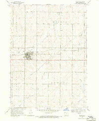
1969 Map of Remsen
USGS Topo · Published 1971About this map
Remsen serves as the central hub of this agricultural landscape in Plymouth County, dominated by the steady movement of the Illinois Central railroad. The town's community structure is anchored by Beck Park and City Park, while the local history of the area is well-preserved through the documentation of St Marys Cem and Remsen Cem. This survey illustrates a post-war rural economy where traditional townships like Fredonia, Meadow, and Marion are increasingly defined by modern infrastructure, including several gravel operations and a prominent Pipeline cutting through the countryside.
Find a feature on this map
22 named features on this map. Tap any name to fly to it.
Don’t see what you’re looking for? This feature index may not catch every label — zoom into the map to look around manually.
Map Details
Editions of this 1969 Remsen Map
This is the sole edition of this map. No revisions or reprints were ever made.
Other maps of this area

1954 · Fort Dodge
USGS Topo · 1:250,000

1955 · Sioux City
USGS Topo · 1:250,000

1957 · Fort Dodge
USGS Topo · 1:250,000

1958 · Sioux City
USGS Topo · 1:250,000

1958 · Fort Dodge
USGS Topo · 1:250,000

1959 · Sioux City
USGS Topo · 1:250,000

1962 · Le Mars
USGS Topo · 1:62,500

1962 · Union Center
USGS Topo · 1:62,500

1969 · Fielding
USGS Topo · 1:24,000
1969 · Granville West
USGS Topo · 1:24,000