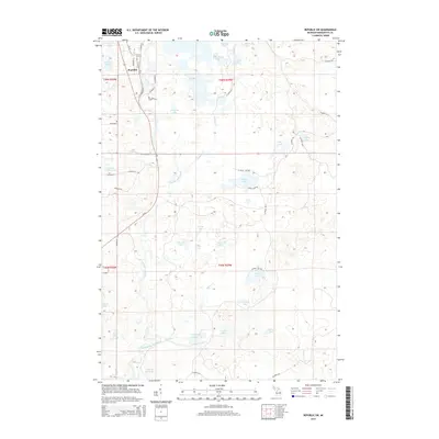
2014 Map of Republic SW
USGS Topo · Published 2014About this map
Republic stands at the northwestern corner of this Michigan landscape, where a dense network of local roads like Hemlock St, Cedar St, and Pine St meet the corridor of State Highway 95. This area is defined by its complex glacial hydrology, featuring a high concentration of water bodies including Saint Clair Lake, Big Lick Lake, and the winding Michigamme River. The settlement pattern is sparse outside of the primary town, with Hardwood representing one of the few named clusters amidst a landscape of timber and water. Local travel is facilitated by numerous county routes, such as Co Road FFW and Co Road LLL, which provide access to the various remote shorelines. The southern reaches are particularly water-dominated, characterized by the Chain of Lakes and the expansive Lake of The Plains, illustrating the transition into the dense woods of the Upper Peninsula.
Find a feature on this map
58 named features on this map. Tap any name to fly to it.
Don’t see what you’re looking for? This feature index may not catch every label — zoom into the map to look around manually.
Map Details
Editions of this 2014 Republic SW Map
This is the sole edition of this map. No revisions or reprints were ever made.
Other maps of this area

1899 · Sagola
USGS Topo · 1:62,500

1899 · Witbeck
USGS Topo · 1:62,500

1955 · Witch Lake
USGS Topo · 1:24,000

1955 · Ralph NW
USGS Topo · 1:24,000

1955 · Ralph NE
USGS Topo · 1:24,000

1955 · Witch Lake NE
USGS Topo · 1:24,000

1955 · Greenwood
USGS Topo · 1:24,000

1955 · Republic
USGS Topo · 1:62,500

1955 · Republic
USGS Topo · 1:24,000

1955 · Witch Lake
USGS Topo · 1:62,500