
1955 Map of Greenwood
USGS Topo · Published 1956About this map
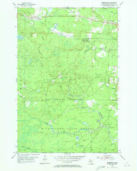
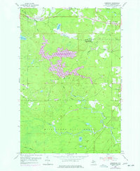
Industrial iron mining and transport dominate this mid-century landscape in the Upper Peninsula, where the Duluth South Shore and Atlantic railroad cuts through the north. The presence of the Greenwood Mine near the settlement of Greenwood and the neighboring South Greenwood (Greenwood Sta) highlights the area's dependency on the mineral extraction economy. Further west, the small community of Clarksburg sits along the rail line, while the southern half of the quadrangle transitions into the protected timberlands of the Michigan State Forest.
Find a feature on this map
26 named features on this map. Tap any name to fly to it.
Don’t see what you’re looking for? This feature index may not catch every label — zoom into the map to look around manually.
Map Details
Editions of this 1955 Greenwood Map
3 editions found
Other maps of this area

1952 · Ishpeming
USGS Topo · 1:62,500

1952 · Ishpeming
USGS Topo · 1:24,000

1954 · Negaunee SW
USGS Topo · 1:24,000

1954 · Negaunee
USGS Topo · 1:62,500

1955 · Champion
USGS Topo · 1:24,000

1955 · Diorite
USGS Topo · 1:24,000

1955 · Republic
USGS Topo · 1:62,500

1955 · Republic
USGS Topo · 1:24,000

1955 · Republic SW
USGS Topo · 1:24,000

1955 · Champion
USGS Topo · 1:62,500