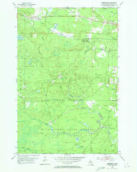
1955 Map of Greenwood
USGS Topo · Published 1973About this map
Iron mining and timber define the landscape in this mid-century survey of Marquette County, centered on the Greenwood and Clarksburg settlements. The rail-heavy economy is anchored by the Duluth South Shore and Atlantic railroad, which services industrial sites like the Greenwood Mine and South Greenwood (Greenwood Sta). To the north, social and recreational life is evidenced by a Drive-in Theater, a Racetrack, and Dexter Landing Field, while the southern portion of the map is dominated by the wilder reaches of the Michigamme State Forest. This southern territory is defined by the complex drainage of the Escanaba River and its various branches, including a Gaging Station and a Boy Scout Camp situated near Island Lake. The map reveals a Michigan Upper Peninsula in transition, where established mining hamlets like Snowville coexist with early-aviation infrastructure and large-scale state forest management.
Find a feature on this map
30 named features on this map. Tap any name to fly to it.
Don’t see what you’re looking for? This feature index may not catch every label — zoom into the map to look around manually.
Map Details
Editions of this 1955 Greenwood Map
3 editions found
Other maps of this area

1952 · Ishpeming
USGS Topo · 1:62,500

1952 · Ishpeming
USGS Topo · 1:24,000

1954 · Negaunee SW
USGS Topo · 1:24,000

1954 · Negaunee
USGS Topo · 1:62,500

1955 · Champion
USGS Topo · 1:24,000

1955 · Diorite
USGS Topo · 1:24,000

1955 · Greenwood
USGS Topo · 1:24,000

1955 · Republic
USGS Topo · 1:62,500

1955 · Republic
USGS Topo · 1:24,000

1955 · Republic SW
USGS Topo · 1:24,000