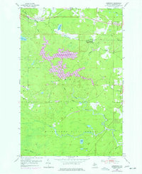
1955 Map of Greenwood
USGS Topo · Published 1977About this map
The Greenwood Reservoir and its surrounding wetlands dominate this 1975 photorevision of the Marquette County landscape. The map captures a transition in the local topography, documenting the reservoir's spillway and flooded timberlines alongside the industrial and social hubs of Greenwood and South Greenwood. To the north, the Duluth South Shore and Atlantic railroad corridor serves as the primary artery connecting the small settlements of Snowville and Clarksburg. This survey provides a precise look at the mid-1970s land use, where recreation and industry converge in the Michigamme State Forest. Cultural landmarks like a Drive-in Theater, a Racetrack, and the Dexter Landing Field sit just north of the Greenwood Mine, while the southern reaches follow the winding course of the Middle Branch Escanaba River.
Find a feature on this map
32 named features on this map. Tap any name to fly to it.
Don’t see what you’re looking for? This feature index may not catch every label — zoom into the map to look around manually.
Map Details
Editions of this 1955 Greenwood Map
3 editions found
Other maps of this area

1952 · Ishpeming
USGS Topo · 1:62,500

1952 · Ishpeming
USGS Topo · 1:24,000

1954 · Negaunee SW
USGS Topo · 1:24,000

1954 · Negaunee
USGS Topo · 1:62,500

1955 · Champion
USGS Topo · 1:24,000

1955 · Diorite
USGS Topo · 1:24,000

1955 · Greenwood
USGS Topo · 1:24,000

1955 · Republic
USGS Topo · 1:62,500

1955 · Republic
USGS Topo · 1:24,000

1955 · Republic SW
USGS Topo · 1:24,000