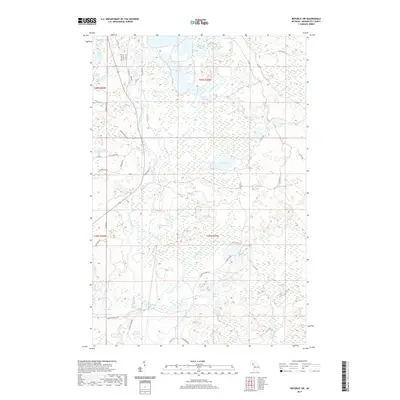
2019 Map of Republic SW
USGS Topo · Published 2019About this map
The Michiganme River winds through this heavily glaciated pocket of Marquette County, defining a landscape dominated by interconnected wetlands and small water bodies. The terrain is characterized by intricate drainage patterns, where Wilson Cr and Gambles Cr feed into extensive lowlands like Casey Swamp. The map reveals a sparse network of county roads and specialized tracks, such as Miron's Farm Road and Whip-per-will Rd, which provide access to scattered lakefronts and timberlands. Remote water bodies including Lake of The Plains and the Chain of Lakes stand as central landmarks in this northern wilderness, reflecting the region's enduring character as a destination for outdoor recreation and seasonal residences.
Find a feature on this map
57 named features on this map. Tap any name to fly to it.
Don’t see what you’re looking for? This feature index may not catch every label — zoom into the map to look around manually.
Map Details
Editions of this 2019 Republic SW Map
This is the sole edition of this map. No revisions or reprints were ever made.
Other maps of this area

1899 · Sagola
USGS Topo · 1:62,500

1899 · Witbeck
USGS Topo · 1:62,500

1955 · Witch Lake
USGS Topo · 1:24,000

1955 · Ralph NW
USGS Topo · 1:24,000

1955 · Ralph NE
USGS Topo · 1:24,000

1955 · Witch Lake NE
USGS Topo · 1:24,000

1955 · Greenwood
USGS Topo · 1:24,000

1955 · Republic
USGS Topo · 1:62,500

1955 · Republic
USGS Topo · 1:24,000

1955 · Witch Lake
USGS Topo · 1:62,500