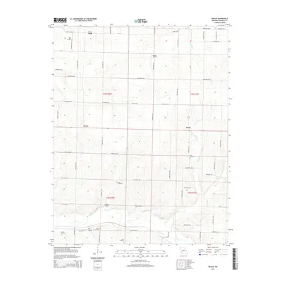
2015 Map of Rescue
USGS Topo · Published 2015About this map
Grays Point, Rescue, and Phelps anchor this rural Lawrence County landscape, where agriculture and small aviation coexist. The northern section is marked by Kingsley Airfield, situated amidst a grid of farm roads such as Mo-YY and The Boulevard. For genealogists, the map is particularly valuable for its density of burial sites, including Grays Point Cemetery, Cole Cemetery, Goss Cemetery, and Hodge Cemetery near Dry Hollow. The southern portion of the quadrangle transitions into more varied terrain defined by the Spring River and its tributaries like Stahl Cr. These waterways are flanked by local landmarks such as Colley Hollow, providing a clear picture of the land's drainage and historical farm boundaries in the early 21st century.
Find a feature on this map
58 named features on this map. Tap any name to fly to it.
Don’t see what you’re looking for? This feature index may not catch every label — zoom into the map to look around manually.
Map Details
Editions of this 2015 Rescue Map
This is the sole edition of this map. No revisions or reprints were ever made.
Other maps of this area

1886 · Greenfield
USGS Topo · 1:125,000

1886 · Carthage
USGS Topo · 1:125,000

1888 · Greenfield
USGS Topo · 1:125,000

1894 · Carthage
USGS Topo · 1:125,000

1921 · Stotts City
USGS Topo · 1:62,500

1921 · Sarcoxie
USGS Topo · 1:62,500

1947 · Joplin
USGS Topo · 1:250,000

1949 · Joplin
USGS Topo · 1:250,000

1954 · Springfield
USGS Topo · 1:250,000

1954 · Joplin
USGS Topo · 1:250,000