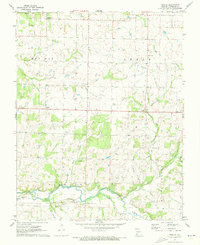
1971 Map of Rescue
USGS Topo · Published 1973About this map
Spring River meanders across this rural Missouri landscape, following the southern reaches of Lawrence County where agriculture and transportation infrastructure intersect. The Missouri Pacific rail line cuts through the valley, serving Stotts City (Sta) and mirroring the path of several industrial utility lines labeled as Pipeline. This 1970s survey captures the region's established social geography, marked by numerous rural burying grounds including Grays Point Cem, Goss Cem, and Beck Cem. Small rural centers like Rescue, Phelps, and Grays Point appear as dispersed settlements connected by a grid of local roads and sections. The presence of Stone Chapel and West Sch points to the community foundations of the area, while the terrain is defined by the carved paths of Dry Fork, Stahl Creek, and Colley Hollow as they drain toward the river system.
Find a feature on this map
24 named features on this map. Tap any name to fly to it.
Don’t see what you’re looking for? This feature index may not catch every label — zoom into the map to look around manually.
Map Details
Editions of this 1971 Rescue Map
This is the sole edition of this map. No revisions or reprints were ever made.
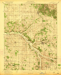
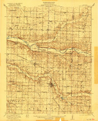
Other maps of this area

1886 · Greenfield
USGS Topo · 1:125,000

1886 · Carthage
USGS Topo · 1:125,000

1888 · Greenfield
USGS Topo · 1:125,000

1894 · Carthage
USGS Topo · 1:125,000
1921 · Stotts City
USGS Topo · 1:62,500
1921 · Sarcoxie
USGS Topo · 1:62,500

1947 · Joplin
USGS Topo · 1:250,000

1949 · Joplin
USGS Topo · 1:250,000

1954 · Springfield
USGS Topo · 1:250,000

1954 · Joplin
USGS Topo · 1:250,000