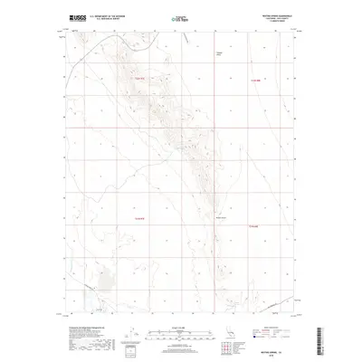
2018 Map of Resting Spring
USGS Topo · Published 2018About this map
Resting Springs and Chappo Spring serve as critical water points in this arid section of the Mojave Desert. The landscape is dominated by north-south trending ridges that separate the Chicago Valley from the surrounding basin, with the ephemeral Amargosa River cutting through the western portion of the terrain. Historical transit is etched into the desert floor here, with the Old Spanish Trl crossing the southeastern corner, a route that once connected Santa Fe to Los Angeles. Surface infrastructure remains sparse, limited primarily to primitive routes like Chicago Valley Rd and Furnace Creek Rd, reflecting the enduring isolation of this part of Inyo County. The presence of these named springs suggests their continued importance for wildlife and navigation in a region defined by its extreme water scarcity.
Find a feature on this map
13 named features on this map. Tap any name to fly to it.
Don’t see what you’re looking for? This feature index may not catch every label — zoom into the map to look around manually.
Map Details
Editions of this 2018 Resting Spring Map
This is the sole edition of this map. No revisions or reprints were ever made.
Other maps of this area

1908 · Furnace Creek
USGS Topo · 1:250,000

1910 · Furnace Creek
USGS Topo · 1:250,000

1933 · Avawatz Mountains
USGS Topo · 1:250,000

1940 · Eagle Tank
USGS Topo · 1:62,500

1947 · Trona
USGS Topo · 1:250,000

1948 · Trona
USGS Topo · 1:250,000

1948 · Death Valley
USGS Topo · 1:250,000

1950 · Tecopa
USGS Topo · 1:62,500

1951 · Tecopa
USGS Topo · 1:62,500

1951 · Eagle Mtn
USGS Topo · 1:62,500