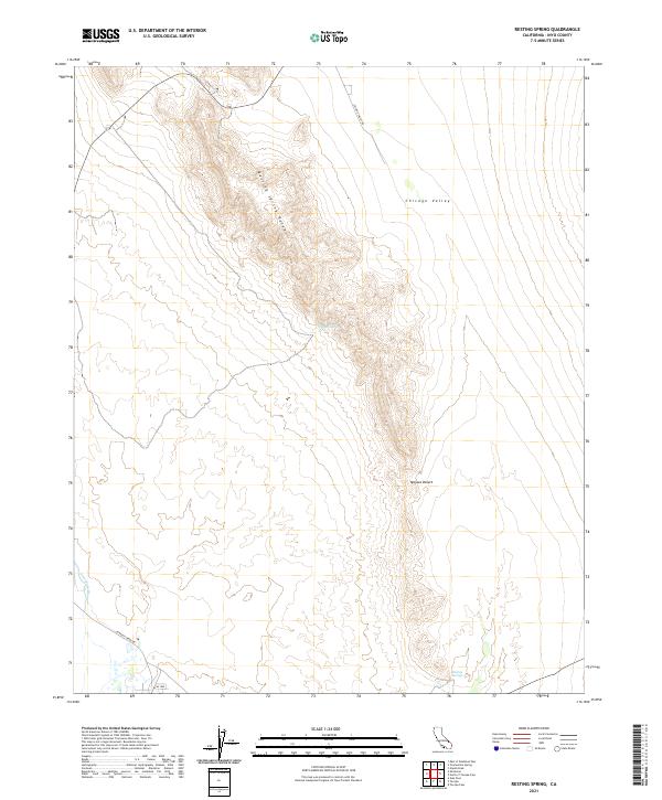
2021 Map of Resting Spring
USGS Topo · Published 2021About this map
The Resting Spring Range forms a prominent north-south spine across this high-desert landscape in eastern Inyo County, situated within the northern reaches of the Mojave Desert. This topographic study reveals a terrain defined by stark elevation changes between the jagged peaks of the range and the broad, dry expanse of the Chicago Valley to the east. The presence of water, while scarce, is concentrated at specific points like Chappo Spring and the namesake Resting Springs at the base of the mountains.
Find a feature on this map
13 named features on this map. Tap any name to fly to it.
Don’t see what you’re looking for? This feature index may not catch every label — zoom into the map to look around manually.
Map Details
Editions of this 2021 Resting Spring Map
This is the sole edition of this map. No revisions or reprints were ever made.
Other maps of this area

1908 · Furnace Creek
USGS Topo · 1:250,000

1910 · Furnace Creek
USGS Topo · 1:250,000

1933 · Avawatz Mountains
USGS Topo · 1:250,000

1940 · Eagle Tank
USGS Topo · 1:62,500

1947 · Trona
USGS Topo · 1:250,000

1948 · Trona
USGS Topo · 1:250,000

1948 · Death Valley
USGS Topo · 1:250,000

1950 · Tecopa
USGS Topo · 1:62,500

1951 · Tecopa
USGS Topo · 1:62,500

1951 · Eagle Mtn
USGS Topo · 1:62,500