
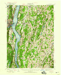
1934 Map of Rhinebeck
USGS Topo · Published 1934About this map
Hudson River commerce and rail transportation define this mid-1930s landscape, where the New York Central and Hudson River RR skirts the eastern shore. The map documents an area deeply shaped by prominent estates and religious institutions, including the massive Mt St Alphonsus Seminary and Holy Cross Seminary near the water's edge. Navigation aids like the Kingston Lighthouse and Esopus Meadow Lighthouse remain critical fixtures of the river corridor, while inland, the terrain transitions into a dense network of hamlets like Wurtemburg and Rock City. The map provides excellent genealogical detail for the period, locating numerous rural schools such as the Fallkill Sch and Willow Glen Sch, alongside social landmarks like the Red Hook Golf Club and the Camp Nooteeming boy scout camp.
Find a feature on this map
130 named features on this map. Tap any name to fly to it.
Don’t see what you’re looking for? This feature index may not catch every label — zoom into the map to look around manually.
Map Details
Editions of this 1934 Rhinebeck Map
2 editions found
Other maps of this area

1892 · Kaaterskill
USGS Topo · 1:62,500

1893 · Kaaterskill
USGS Topo · 1:62,500

1893 · Clove
USGS Topo · 1:62,500

1893 · Poughkeepsie
USGS Topo · 1:62,500

1894 · Clove
USGS Topo · 1:62,500

1894 · Kaaterskill
USGS Topo · 1:62,500

1894 · Poughkeepsie
USGS Topo · 1:62,500

1895 · Catskill
USGS Topo · 1:62,500

1898 · Clove
USGS Topo · 1:62,500

1898 · Rhinebeck
USGS Topo · 1:62,500