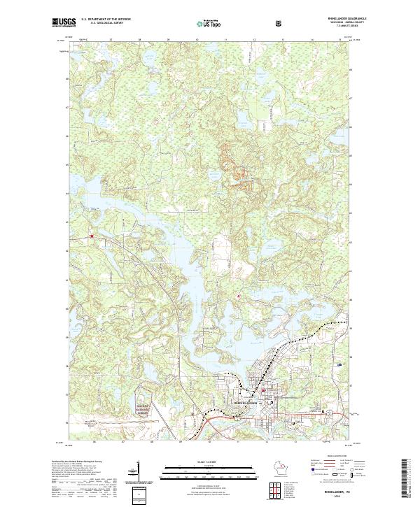
2022 Map of Rhinelander
USGS Topo · Published 2022About this map
Rhinelander sits at the vital confluence of the Wisconsin River and the Pelican River, a landscape dominated by the extensive waters of Boom Lake and the Rhinelander Flowage. This 2022 survey shows the modern footprint of the city, centered on the Oneida County Courthouse and extending toward the Rhinelander-Oneida County Airport. The surrounding Northwoods terrain is a complex network of glacial kettle lakes, including Crystal Lake, Silver Lake, and Thunder Lake, many of which are protected within the boundaries of the Nicolet National Forest.
Find a feature on this map
101 named features on this map. Tap any name to fly to it.
Don’t see what you’re looking for? This feature index may not catch every label — zoom into the map to look around manually.
Map Details
Editions of this 2022 Rhinelander Map
This is the sole edition of this map. No revisions or reprints were ever made.
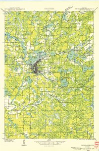
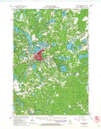
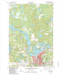
Historical Maps of Rhinelander Through Time
6 maps found