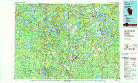
1989 Map of Rhinelander
USGS Topo · Published 1990About this map
Rhinelander sits at the heart of this Northwoods landscape, where the Wisconsin River winds through a dense network of glacial lakes and managed timberlands. In the late 1980s, this region was defined by its vast public lands, including the American Legion State Forest and the Nicolet National Forest. The map documents a complex aquatic geography, from the sprawling Willow Reservoir and Rainbow Flowage to the intricate shorelines of Tomahawk Lake and Pelican Lake.
Find a feature on this map
76 named features on this map. Tap any name to fly to it.
Don’t see what you’re looking for? This feature index may not catch every label — zoom into the map to look around manually.
Map Details
Editions of this 1989 Rhinelander Map
This is the sole edition of this map. No revisions or reprints were ever made.
Other maps of this area

1928 · Three Lakes
USGS Topo · 1:48,000

1930 · Robbins
USGS Topo · 1:48,000

1938 · Phelps
USGS Topo · 1:48,000

1938 · Minocqua
USGS Topo · 1:48,000

1938 · Alvin
USGS Topo · 1:48,000

1938 · Three Lakes
USGS Topo · 1:48,000

1938 · Robbins
USGS Topo · 1:48,000

1938 · Lac Du Flambeau
USGS Topo · 1:48,000

1939 · Trout Lake
USGS Topo · 1:48,000

1939 · Lac Du Flambeau
USGS Topo · 1:48,000