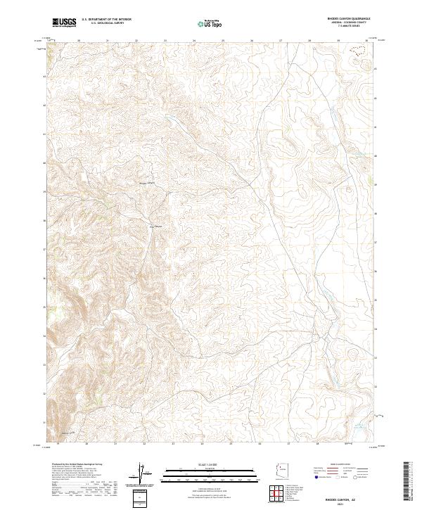
2021 Map of Rhodes Canyon
USGS Topo · Published 2021About this map
Rhodes Canyon and Pine Canyon cut through a remote corner of Coconino County, where the high desert landscape is defined by the dramatic escarpment of the Aubrey Cliffs. This 2021 survey illustrates a sparse ranching and water management network, where isolated man-made catchments like Deer Tank, Jack Stephens Tank, and Sheep Ranch Tank provide critical resources in an arid environment. The drainage of Chino Wash meanders through the eastern portion of the quadrangle, carving a path between low ridges. The map reveals the precise Public Land Survey System grid across Townships 25 and 26 North, showing how section lines and primitive roads navigate the complex terrain of the Arizona strip.
Find a feature on this map
11 named features on this map. Tap any name to fly to it.
Don’t see what you’re looking for? This feature index may not catch every label — zoom into the map to look around manually.
Map Details
Editions of this 2021 Rhodes Canyon Map
This is the sole edition of this map. No revisions or reprints were ever made.
Other maps of this area

1886 · Diamond Creek
USGS Topo · 1:250,000

1886 · Chino
USGS Topo · 1:250,000

1891 · Chino
USGS Topo · 1:250,000

1892 · Diamond Creek
USGS Topo · 1:250,000

1948 · Williams
USGS Topo · 1:250,000

1954 · Williams
USGS Topo · 1:250,000

1956 · Williams
USGS Topo · 1:250,000

1960 · Williams
USGS Topo · 1:250,000

1961 · Williams
USGS Topo · 1:250,000
1980 · Rose Well Camp West
USGS Topo · 1:24,000