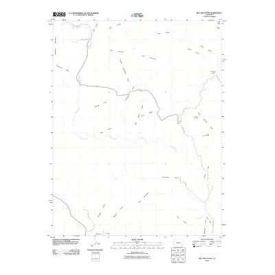
2010 Map of Rice Mountain
USGS Topo · Published 2010About this map
Blue Nugget Mine and the Hoppy Claim anchor the northern reaches of this Colorado landscape, marking a legacy of extraction near Rice Mountain. The area is defined by a network of drainage systems including Wilson Creek and Rice Gulch, which carve through the high terrain. To the south, the topography opens into several distinct basins such as Webster Park, Shaws Park, and Eightmile Park. This map reveals a complex web of remote access routes like County Rd 345A and Wilson Creek Rd, essential for navigating the ridges and gulches that dominate the terrain. Evidence of water management and further mining activity appears at Little Johnny Dam and the Red Cliff Thirty Mine, illustrating how humans have adapted to and utilized this section of Fremont County.
Find a feature on this map
35 named features on this map. Tap any name to fly to it.
Don’t see what you’re looking for? This feature index may not catch every label — zoom into the map to look around manually.
Map Details
Editions of this 2010 Rice Mountain Map
This is the sole edition of this map. No revisions or reprints were ever made.
Other maps of this area

1889 · Canon City
USGS Topo · 1:125,000

1892 · Canon City
USGS Topo · 1:125,000

1894 · Pikes Peak
USGS Topo · 1:125,000

1901 · Pikes Peak
USGS Topo · 1:125,000

1942 · Cover Mtn.
USGS Topo · 1:62,500

1948 · Cover Mtn.
USGS Topo · 1:62,500

1951 · Cripple Creek South
USGS Topo · 1:24,000

1954 · Cooper Mountain
USGS Topo · 1:24,000

1954 · Pueblo
USGS Topo · 1:250,000

1957 · Pueblo
USGS Topo · 1:250,000