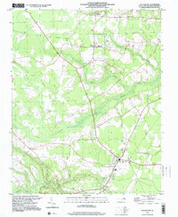
1997 Map of Rich Square
USGS Topo · Published 2000About this map
Rich Square serves as the primary hub of this Northampton County landscape, situated at the junction of several regional transit routes. The surrounding terrain is defined by the intricate hydrology of the Urahaw Swamp and Bear Swamp, which weave through the agricultural and timber lands of the Coastal Plain. Evidence of historical transportation is clear in the Old Railroad Grade that cuts across the northern reaches, passing near the settlement of Lasker. Local community life is anchored by numerous rural institutions, including Creecy Sch and Northeast Academy, alongside a high density of small family cemeteries and churches like New Hope Ch and Cumbo Chapel. These features suggest a long-established pattern of rural settlement where small townships like Bryantown and Lassiter Crossroads developed along the higher ground between the extensive swamp systems.
Find a feature on this map
25 named features on this map. Tap any name to fly to it.
Don’t see what you’re looking for? This feature index may not catch every label — zoom into the map to look around manually.
Map Details
Editions of this 1997 Rich Square Map
This is the sole edition of this map. No revisions or reprints were ever made.
Other maps of this area

1953 · Norfolk
USGS Topo · 1:250,000

1962 · Scotland Neck
USGS Topo · 1:24,000

1962 · Norfleet
USGS Topo · 1:24,000
1973 · Conway
USGS Topo · 1:24,000

1973 · Kelford
USGS Topo · 1:24,000

1974 · Boones Crossroads
USGS Topo · 1:24,000

1974 · Rich Square
USGS Topo · 1:24,000
1974 · Jackson
USGS Topo · 1:24,000
1975 · Galatia
USGS Topo · 1:24,000

1977 · Woodland
USGS Topo · 1:24,000