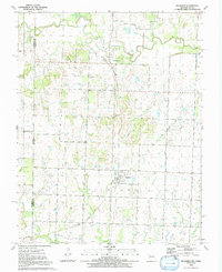
1991 Map of Richards
USGS Topo · Published 1991About this map
The Little Osage River winds across the northern landscape of this Missouri-Kansas borderlands survey, defining a terrain of broad levees and frequent creek confluences. In the township of Henry, the settlement of Stotesbury sits near the riverbanks, while the village of Richards serves as a central hub further south in Richland. The topography is marked by the Rombaugh Hills and Hickman Hill, punctuating an area primarily shaped by agriculture and resource extraction.
Find a feature on this map
22 named features on this map. Tap any name to fly to it.
Don’t see what you’re looking for? This feature index may not catch every label — zoom into the map to look around manually.
Map Details
Editions of this 1991 Richards Map
This is the sole edition of this map. No revisions or reprints were ever made.
Other maps of this area

1884 · Fort Scott
USGS Topo · 1:125,000

1886 · Nevada
USGS Topo · 1:125,000

1886 · Fort Scott
USGS Topo · 1:125,000

1887 · Butler
USGS Topo · 1:125,000

1887 · Mound City
USGS Topo · 1:125,000

1893 · Fort Scott
USGS Topo · 1:125,000

1893 · Mound City
USGS Topo · 1:125,000

1894 · Butler
USGS Topo · 1:125,000

1894 · Nevada
USGS Topo · 1:125,000

1938 · Metz
USGS Topo · 1:24,000