2023 Map of Richfield Springs
USGS Topo · Published 2023About this map
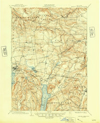
The village of Richfield Springs serves as a northern gateway to the glacial waters of Canadarago Lake, a landscape defined by sharp elevation changes across Waiontha Mountain and Rum Hill. To the south, the terrain descends toward Otsego Lake, where the Susquehanna River begins its long journey through several prominent points like Hutter Point and Fivemile Point. This modern survey reveals a countryside dense with genealogical markers, including the uniquely named Twelve Thousand Cem and several smaller family-named burial grounds like Fitch Hill Cem and Thurston Hill Cem. The rural character of the region is preserved through the maintenance of small settlements like Pierstown, Warren, and Springfield Center, which remain connected by a network of local routes such as Hogsback Rd and Co Rd 78 that navigate around Maumee Swamp and Weaver Lake.
Find a feature on this map
144 named features on this map. Tap any name to fly to it.
Don’t see what you’re looking for? This feature index may not catch every label — zoom into the map to look around manually.
Map Details
Editions of this 2023 Richfield Springs Map
This is the sole edition of this map. No revisions or reprints were ever made.
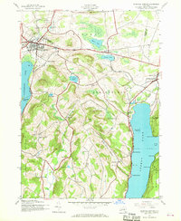
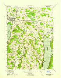
Historical Maps of Middlefield Through Time
4 maps found