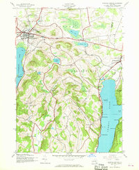
1943 Map of Richfield Springs
USGS Topo · Published 1968About this map
Richfield Springs serves as the primary hub on this map, situated where the D L & W railroad meets the road network just south of the Herkimer and Otsego county line. The landscape is defined by the high ground between two major water bodies, Canadarago Lake to the west and the northern reach of Otsego Lake to the east. This 1940s topography captures a rural network of named hills and hollows, including Wedderspoon Hollow and Mexican Canyon, which separate the various town districts.
Find a feature on this map
61 named features on this map. Tap any name to fly to it.
Don’t see what you’re looking for? This feature index may not catch every label — zoom into the map to look around manually.
Map Details
Editions of this 1943 Richfield Springs Map
2 editions found
Other maps of this area

1903 · Richfield Springs
USGS Topo · 1:62,500

1907 · Winfield
USGS Topo · 1:62,500

1907 · Cooperstown
USGS Topo · 1:62,500

1909 · Cooperstown
USGS Topo · 1:62,500

1910 · Hartwick
USGS Topo · 1:62,500

1912 · Hartwick
USGS Topo · 1:62,500

1943 · Schuyler Lake
USGS Topo · 1:24,000

1943 · Jordanville
USGS Topo · 1:24,000

1943 · Richfield Springs
USGS Topo · 1:24,000

1943 · Westford
USGS Topo · 1:24,000