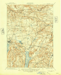
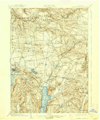
1903 Map of Richfield Springs
USGS Topo · Published 1948About this map
Richfield Springs serves as a major hub at the dawn of the twentieth century, anchored by the D L & W R R and the waters of Canadarago Lake. The map reveals a densely settled agricultural and recreational landscape, where a Steamboat Route traverses the length of Otsego Lake toward Hyde Bay. This region, split by the Herkimer Co Otsego Co line, is defined by narrow valleys and prominent heights like Waiontha Mt and Otsego Mt. Smaller hamlets such as Jordanville, Vanhornesville, and Cherry Valley appear in their historic configurations, linked by a network of early roads and trout-filled waters like Shadow Brook and Otsquago Creek. The presence of many small settlements like Willse Four Corners and Paines Hollow suggests a vibrant rural economy before the widespread adoption of the automobile consolidated these local centers.
Find a feature on this map
78 named features on this map. Tap any name to fly to it.
Don’t see what you’re looking for? This feature index may not catch every label — zoom into the map to look around manually.
Map Details
Editions of this 1903 Richfield Springs Map
6 editions found
Other maps of this area

1898 · Utica
USGS Topo · 1:62,500

1898 · Canajoharie
USGS Topo · 1:62,500

1900 · Little Falls
USGS Topo · 1:62,500

1900 · Utica
USGS Topo · 1:62,500

1900 · Canajoharie
USGS Topo · 1:62,500

1901 · Lassellsville
USGS Topo · 1:62,500

1902 · Canajoharie
USGS Topo · 1:62,500

1903 · Richfield Springs
USGS Topo · 1:62,500

1903 · Lassellsville
USGS Topo · 1:62,500

1903 · Little Falls
USGS Topo · 1:62,500