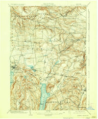
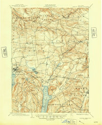
1903 Map of Richfield Springs
USGS Topo · Published 1923About this map
Otsego Lake and the northern reaches of the Susquehanna headwaters anchor this 1903 edition survey, which illustrates a landscape of established dairy farms and early tourism. At the southern end of the sheet, a Steamboat Route traverses the length of the lake toward Hyde Bay, while to the west, the resort village of Richfield Springs is served by the D. L. & W. R. R. and overlooks Canadarago Lake.
Find a feature on this map
74 named features on this map. Tap any name to fly to it.
Don’t see what you’re looking for? This feature index may not catch every label — zoom into the map to look around manually.
Map Details
Editions of this 1903 Richfield Springs Map
6 editions found
Other maps of this area

1898 · Utica
USGS Topo · 1:62,500

1898 · Canajoharie
USGS Topo · 1:62,500

1900 · Little Falls
USGS Topo · 1:62,500

1900 · Utica
USGS Topo · 1:62,500

1900 · Canajoharie
USGS Topo · 1:62,500

1901 · Lassellsville
USGS Topo · 1:62,500

1902 · Canajoharie
USGS Topo · 1:62,500

1903 · Richfield Springs
USGS Topo · 1:62,500

1903 · Lassellsville
USGS Topo · 1:62,500

1903 · Little Falls
USGS Topo · 1:62,500