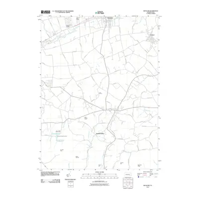
2010 Map of Richland
USGS Topo · Published 2010About this map
Myerstown and Richland anchor the northern landscape of this region, where the Pennsylvania countryside transitions from agricultural flats into the prominent rises of the Furnace Hills. This area is defined by a complex network of waterways and early water-control infrastructure, including the Tulpehocken Fishing Club Dam on Tulpehocken Creek and the southern Lebanon Reservoir. Small aviation hubs like the Keller Brothers Airport and Lebanon Valley Airpark are situated amidst the fields, reflecting the rural-industrial mix of the early 21st century.
Find a feature on this map
80 named features on this map. Tap any name to fly to it.
Don’t see what you’re looking for? This feature index may not catch every label — zoom into the map to look around manually.
Map Details
Editions of this 2010 Richland Map
This is the sole edition of this map. No revisions or reprints were ever made.
Other maps of this area

1891 · Lebanon
USGS Topo · 1:62,500

1893 · Lebanon
USGS Topo · 1:62,500

1899 · Lebanon
USGS Topo · 1:62,500

1902 · Wernersville
USGS Topo · 1:62,500

1902 · Lancaster
USGS Topo · 1:62,500

1904 · Lancaster
USGS Topo · 1:62,500

1906 · New Holland
USGS Topo · 1:62,500

1908 · New Holland
USGS Topo · 1:62,500

1941 · New Holland
USGS Topo · 1:62,500

1943 · Lancaster
USGS Topo · 1:62,500
Featured Places
- Clay Township, PA
- Richland, PA
- Elizabeth Township, PA
- Prescott, South Lebanon Township
- Reistville, Heidelberg Township